 National wildlife census officials preparing for the count/WRTI
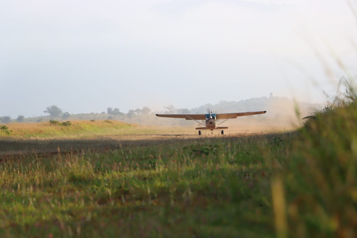
Three light aircraft are hovering across the Wajir and Garissa landscape as wildlife census officials embark on the National Wildlife Count in the latest bid aimed at safeguarding iconic species.
The National Wildlife Census, which commenced in July 2024 and is expected to end in June 2025, is aimed at establishing the current status of wildlife populations, trends and their distribution across Kenya.
“This aerial survey provides a much-needed snapshot of the state of our ecosystems in Garissa and Wajir. These areas are key habitats for several important species,” Wildlife Research and Training Institute (WRTI) Principal Scientist Bernard Ngoru said.
Ngoru emphasised the significance of the exercise in shaping wildlife management policies and resource allocation.
“According to the 2021 National Wildlife Census, Wajir county recorded approximately 6,120 reticulated giraffes, while Garissa county recorded 4,830, underscoring the region 's significance in safeguarding this endangered species. The icon species, known for its distinctive coat pattern, faces a myriad of challenges, both intrinsic and extrinsic, and there is a need to conserve them,” Ngoru added.
The official said the findings of the survey will be instrumental in guiding national and county governments, conservation organisations and communities in making informed decisions on land use planning, wildlife protection and conflict mitigation.
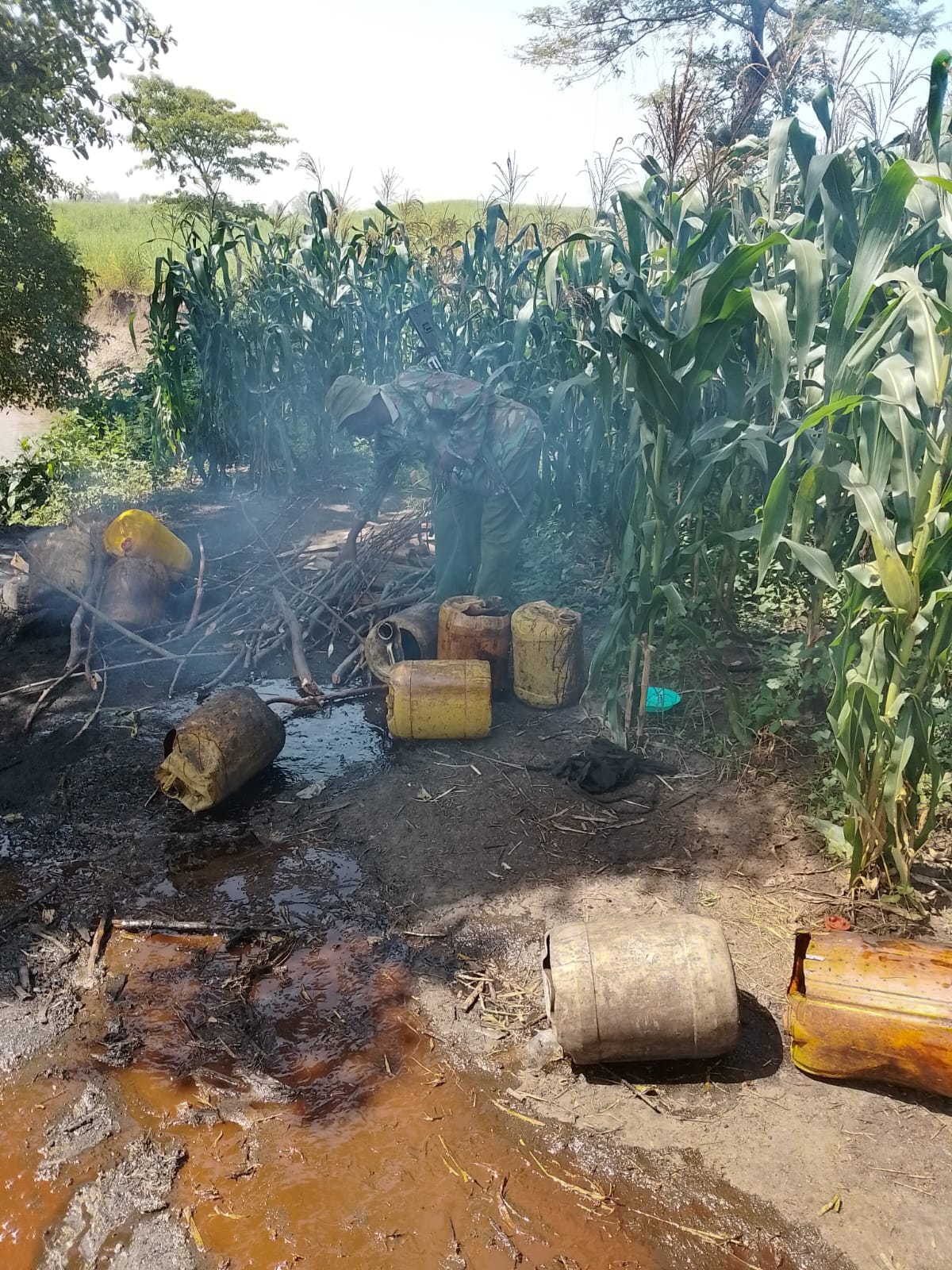
“This is not just about counting animals. It is about understanding our ecosystems holistically—how wildlife coexists with pastoralism, how climate change is affecting vegetation cover and where pressures such as charcoal burning and settlements are exerting stress on the environment," Ngoru added.
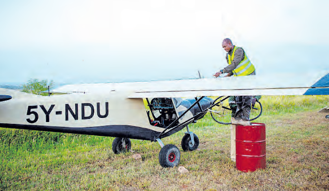
The exercise, which started on June 7, saw each of the three aircraft flying at an average altitude of 400 feet above the ground and a speed of 120-150 kilometres per hour.
Each aircraft is tasked with covering up to 120 sample units, each of 5×5 square kilometres, in a day, operating for around four hours daily.
In an aircraft, there are Front Seat Observers and Rear Seat Observers who are aided by advanced technology.
They scan what is happening at an ecosystem using a bird’s-eye view.
The officials not only count wildlife but also scan the status of the landscape, including human activities, a move that shapes the future of wildlife conservation.
By Monday, the census team had covered 347 sample units.
Once completed, the survey results will be shared with stakeholders and used to update national wildlife databases, inform county spatial plans, and guide the implementation of conservation programs tailored to the unique ecological realities of Garissa and Wajir.
The Garissa-Wajir aerial survey is part of a broader national strategy to improve data-driven conservation through systematic wildlife monitoring.
The initiative aligns with Kenya’s Wildlife Policy and the Wildlife Conservation and Management Act, which underscores the need for evidence-based approaches to conservation and sustainable use of natural resources.
The first phase was finalised and covered Narok–Maasai Mara, Amboseli–Magadi, Athi–Kapiti, Ruma National Park, Nakuru–Naivasha ranches, Lake Nakuru National Park, Mwea National Reserve and Solio Conservancy.
The second phase started with the Laikipia-Isiolo-Samburu-Marsabit-Meru landscapes, the Tsavo ecosystem, and the Nasalop-South Turkana-Kerio Valley ecosystem.
The census is very important, as it will provides accurate data on wildlife populations, which is essential for understanding the health and trends of various species.
This information aids in the development of effective conservation measures to ensure the survival of endangered and threatened species.
The census results will provide a solid foundation for the formulation of decisions and policies that promote the coexistence of wildlife and human activities. It will help address issues such as habitat loss, human-wildlife conflict, and climate change impacts.
Reliable data on wildlife populations will enhance the management of our national parks and reserves and community and private community conservancies, ensuring they remain pristine and attractive destinations for eco-tourism, which is vital for the economy.
The census will also contribute to the body of scientific knowledge on wildlife ecology and behaviour, thus supporting academic research and fostering a deeper understanding of our natural heritage.
Biodiversity is important for those free natural services humans derive.
Such services include and are not limited to clean air, firewood, clean water, flood prevention and pollination, among others that are key to community livelihoods.
The data collected will be instrumental in shaping future wildlife conservation strategies.
Some of the intrinsic threats facing wildlife include diseases and genetic factors, while extrinsic pressures encompass habitat loss due to agricultural expansion, poaching driven by illegal wildlife trade, infrastructure development that fragments their habitats, and the overarching impacts of climate change.
The National Wildlife Census (2024-2025), which is spearheaded by the WRTI in collaboration with Kenya Wildlife Service, Kenya Forest Service, Directorate of Resource Surveys and Remote Sensing, State Department for Wildlife and other partners, is pivotal for informing and guiding conservation strategies, particularly for species like the reticulated giraffes.
By employing advanced technologies, the census will provide insights into wildlife species distribution, population dynamics and habitat utilisation.
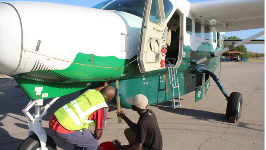
Ahead of the Garissa and Wajir counties National Wildlife Census, the technical team has convened at Amboseli Airstrip to calibrate the three aircraft that are being used in the aerial sample surveys and the field teams.
Amboseli remains the preferred site for the calibration exercise due to its flat terrain, sparse vegetation and established ground markers.
The aircraft—provided by KWS and KFS—were fitted with streamers, and tests were done against the markers on the tarmac airstrip.
Aircraft calibration is a critical component since it ensures data accuracy by determining observation strip width, verifying radar altimeter function, and assessing observer consistency—all essential for generating reliable wildlife population estimates.