There is a 55 per cent chance of a weak La Niña impacting
weather and climate patterns during the next three months, according to the
latest update from the World Meteorological Organisation (WMO).
Even though La Niña has a temporary cooling influence on global average temperatures, many regions are still expected to be warmer than normal.
La Niña refers to the periodic large-scale cooling of the ocean surface temperatures in the central and eastern equatorial Pacific Ocean, coupled with changes in the tropical atmospheric circulation, including changes in winds, pressure and rainfall patterns.
According to the latest forecasts from the WMO Global Producing Centres for Seasonal Prediction, as of mid-November 2025, oceanic and atmospheric indicators reveal borderline La Niña conditions.
There is a 55 per cent probability of crossing La Niña thresholds during the December–February 2025–2026 period.
For January–March and February–April 2026, the likelihood of returning to ENSO-neutral conditions gradually rises from about 65 per cent to 75 per cent. There is little likelihood of an El Niño, which typically has opposite impacts.
“Seasonal forecasts for El Niño and La Niña are essential planning tools for climate-sensitive sectors like agriculture, energy, health and transport. They are also a key component of WMO’s contribution to support humanitarian operations. This climate intelligence helps us to avert millions of dollars in economic losses and to save countless lives,” said WMO secretary general Celeste Saulo.
'ENSO (El Niño-Southern Oscillation)-neutral condition' refers to a state in the tropical Pacific Ocean where sea surface temperatures are close to average.
This means neither the warm El Niño nor the cool La Niña phases of the ENSO are dominant.
The latest update says that from December 2025 to February 2026, temperatures are expected to be above normal in much of the Northern Hemisphere and large parts of the Southern Hemisphere.
Rainfall predictions resemble conditions typically observed during a weak La Niña.
These take into account the influence of key climate variability patterns, such as the North Atlantic Oscillation, the Arctic Oscillation and the Indian Ocean Dipole.
The updates also monitor the global and regional anomalies of surface temperature and precipitation and their evolution over the upcoming season. Global Seasonal Climate Updates.
Naturally occurring large-scale climate events such as La Niña and El Niño are taking place in the broader context of human-induced climate change, which is increasing global temperatures in the long term, exacerbating extreme weather and climate events and impacting seasonal rainfall and temperature patterns.
National Meteorological and Hydrological Services will closely monitor conditions over the coming months to help inform decision-makers.
This happens even as the latest weather forecast by Kenya Met shows that several parts of the country are likely to be sunny and dry.
However, occasional rainfall is expected in a few areas in the Highlands East and West of the Rift Valley, the Rift Valley, the Northeastern, Lake Victoria Basin and the Southeastern lowlands.
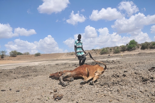
The seasonal outlook for December 2025 to February 2026 shows a high likelihood of suppressed rainfall over the equatorial and southern sectors of the region, stretching across Kenya, southern Uganda and most parts of Tanzania.
The forecast shows warmer-than-usual temperatures are also expected across much of East Africa, with only a few pockets in Ethiopia, Kenya and northeastern Somalia projected to record cooler conditions.
According to ICPAC, central to southern Kenya, southern Uganda, eastern and western Rwanda, most of Burundi and central to northern and southern Tanzania are likely to experience below-normal rainfall during the December–February period.