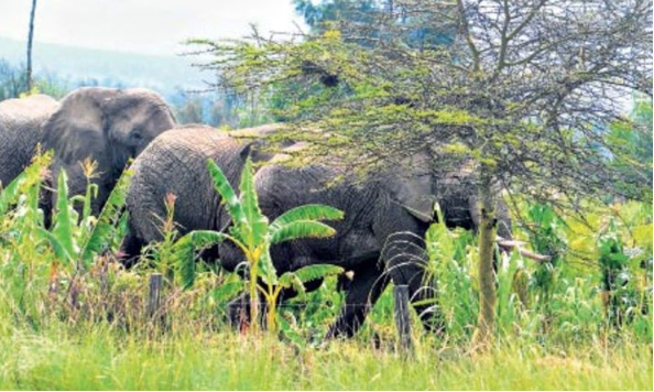
The flare-ups of conflicts between man and jumbos are a result of crops and settlements being close, a new study now suggests.
Approximately 70 per cent of Kenya’s wildlife resides outside protected areas.
Land conversion for agriculture has, over time, exacerbated human–wildlife conflicts, particularly involving elephants.
Wildlife Research and Training Institute, in collaboration with the University of Helsinki, released a publication titled ‘Addressing Human-Elephant Conflicts in Taita Taveta county, Kenya: Integrating Species Distribution Modelling into Targeted Conservation Strategies.’
Tino Johansson, Martha Munyao, Petri Pellikka, Sakari Aarila, Patrick Omondi and Mika Siljander are researchers behind the study.
Taita Taveta county represents a hot spot for human–elephant conflict, where these incidents undermine both conservation efforts and livelihoods.
“To summarise our findings: distance to houses and distance to crops were identified as the most influential predictors of conflict,” part of the study shows.
The study used species distribution models and ensemble modelling to examine the relationship between human–elephant conflict incidents and environmental predictors, subsequently generating and evaluating both probability and risk maps.
In addition, landscape indices were calculated to assess the spatial structure of conflict risk, and a novel method for combining risk metrics was introduced to enhance the evaluation of risk map performance.
The study utilised human–wildlife conflict incident data collected in Taita Taveta county between January 2014 and September 2015.
The data were derived from 3027 compensation request forms submitted to the Kenya Wildlife Service.
These records identified 94 human–elephant conflict incidents with verified geographic coordinates, including 70 crop raiding events and 24 human–related incidents.
The human-related incidents were categorised into human death (six), human injury (six), human threat (11) and property damage.
These data points were compiled into a unified human–elephant conflict incidence point dataset.
A two-step validation process was undertaken before integrating the dataset into the modelling framework.
A detailed review of the compensation request forms was conducted to ensure data consistency.
A field survey was carried out to verify the spatial accuracy of incident locations containing coordinate information.
This validation ensured the reliability of the dataset for subsequent analyses.
The study examined predictor variables that influence human–elephant conflicts, selecting factors with strong support in the literature.
In Taita Taveta county, three forms of human–elephant conflict constituted 97 per cent of all reported incidents over 15 years (2004–2018): threats to human safety represented the largest share (62.46 per cent), followed by crop raiding (32.46 per cent) and property damage (2.33 per cent).
These conflict incidents—including crop raiding, property destruction and human casualties—have significant impacts on both human livelihoods and elephant populations.
Human–elephant conflict has emerged as a pressing concern for the communities of Taita Taveta county and, more broadly, for the Kenyan government due to its profound social and conservation implications.
“The study shows that the increasing competition for space and resources within the agriculture-conservation interface poses critical challenges to wildlife conservation.”
It says the negative impact of human–elephant conflict incidents on both wildlife conservation and human communities underscores the urgency of developing effective mitigation strategies.
“Our findings provide a critical contribution to the conservation ecology literature by offering a novel framework for human–elephant conflict modelling.”
The study shows mitigating conflicts requires an understanding of the spatial distribution of elephants and characteristics of conflict risk zones, which can facilitate targeted management interventions and inform policies that balance conservation priorities with human needs.
“Species distribution modelling has become a prominent approach in human–wildlife conflict research, offering a powerful tool to analyse the extent and patterns of human–environment interactions.”
The researchers said the model enables them to identify factors driving conflict risk, develop models to predict the likelihood of conflict occurrence and guide management decisions and mitigation policies.
They said land conversion for agriculture in ecosystems adjacent to national parks and other protected areas exacerbates these conflicts, heightening interactions between rural communities and wildlife.
Consequently, wildlife conservation efforts and conflict mitigation strategies that focus solely on existing protected areas have proven inadequate.
The study comes even as the state intensifies community engagement forums on Human-Wildlife Conflict compensation in hot spot counties.