

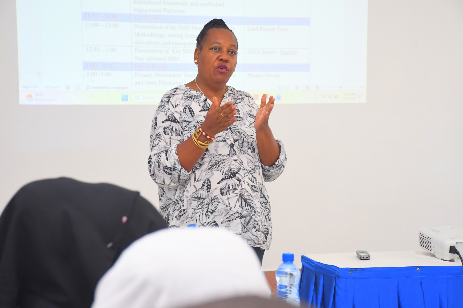
 Chief Research Scientist at Kenya Marine and Fisheries Research Institute (KMFRI) Dr Jacqueline Uku gives her remarks during a private sector stakeholders' engagement on the validation of the Marine Spatial Plan at KMFRI Headquarters.
 Kenya is edging closer to its first-ever Marine Spatial Plan (MSP), a major policy framework expected to transform the management of marine resources.
The 20-year plan, which has already received Cabinet approval, seeks to provide a structured approach to the sustainable and integrated use of Kenya’s 250,000 square kilometres of ocean territory.
It aims to balance economic development, environmental protection, and social inclusion in the management of marine resources.
The MSP is being developed by the State Department for Blue Economy and Fisheries with support from the World Bank through the Kenya Marine Fisheries and Socio-Economic Development (KEMFSED) Project.
The framework covers coastal waters within Kwale, Mombasa, Kilifi, Lamu and Tana River counties, as well as Kenya’s territorial waters and Exclusive Economic Zone (EEZ), areas that continue to face mounting pressure from increasing economic activity and competing users.
Globally, Marine Spatial Planning has emerged as a critical tool for improving governance and coordinating activities within marine environments.
Upon implementation, Kenya will become only the second African nation after South Africa to adopt a comprehensive Marine Spatial Plan.
The initiative aligns with Kenya’s Vision 2030 development blueprint, which identifies MSP as a key enabler of growth within the food economy.
The country’s Fourth Medium-Term Plan (MTP IV) also recognises the Blue Economy as a strategic pillar for economic expansion.
Speaking during a validation exercise in Mombasa, Jacqueline Uku, the National Coordinator for Marine Spatial Planning, said the framework is intended to support sustainable resource use while safeguarding marine ecosystems.
“The plan provides us with ideas for resource use, spaces that we need to preserve, spaces that we can use for development,” Uku said.
“At the end of the day, what we expect to receive as an MSP is something that is validated both environmentally through NEMA and validated through planning organisations like the National Land Commission, which provides oversight on the process and also the planning department that has guided various elements of this process,” she added.
She said the ocean remains one of the country’s least understood resource frontiers despite its enormous potential.
She commended experts, community groups, beach management units, boat operators, private sector players and government agencies for their contributions to the validation process.
“It is very easy to plan on land because you can see where the forest starts and ends. It is very easy to see where the water bodies start and end, where fields start and end, where farmlands are, and where settlements are. The ocean also has its settlements for the ocean community, but they cannot be seen,” she explained.
She added, “It is the experts who have been showing us what exists. This is a plan that relies heavily on the science of the ocean to actually reveal what lies under the blue water that we so admire when we come to the coast.”
Stakeholders from different sectors have also submitted recommendations aimed at strengthening the final document.
Tom Mboya, manager of Telkom’s undersea fibre-optic cable network, welcomed the draft plan but urged planners to clearly designate landing sites and cable corridors to accommodate future expansion.
Kenya currently hosts nine submarine fibre-optic cables, a number that could rise to 20 within the next 20 years.
“We need areas on the beach where they can be able to allow a corridor for the cables to come in from the sea. We normally call it a landing point or a landfall. We need to have some within the region which do not interfere with the navigational paths," Mboya said.
He called for awareness programmes targeting beach management units to enhance understanding of submarine cable infrastructure and reduce potential conflicts with operators.
“The other problem is usually the blockade by some of the private owners of property next to the beach. They usually block certain paths, which could be very important for cables to land. We also don’t want only one convergent point for the cables to land,” he added.
Mombasa executive for blue economy Ibrahim Khamis said the county government is paying close attention to discussions surrounding maritime boundaries.
“We want our area to extend to the ocean, not to lose out on the annual equitable share of funds by the national government,” he said.
Rabia Hawa, director and founder of Ulinzi Africa Foundation, highlighted the need for the plan to adequately consider biodiversity conservation, land and water-use interactions, and migratory routes used by mammals.
She pointed to the hippopotamus as one of the aquatic species requiring greater attention within the framework, noting that it is classified as vulnerable by the International Union for Conservation of Nature (IUCN).
“It is a species of critical importance globally, and we feel like that kind of recognition needs to be made in the process of the MSP," Hawa said.


![[PHOTOS] The Star, Chinese Embassy host Kenya-China media dialogue](https://cdn.radioafrica.digital/image/2026/06/215e29cd-5ca2-4faf-bb4e-d1686b2c3dad.jfif)